Aerial Gallery
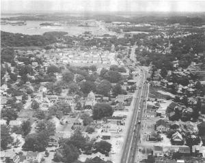
Aerial view Route 3A toward Hingham | PDF Map View | |
Aerial photo looking down Route 3A towards Hingham. (1938) |
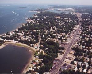
Route 3A (view towards Hingham) Aerial 2002. |
|
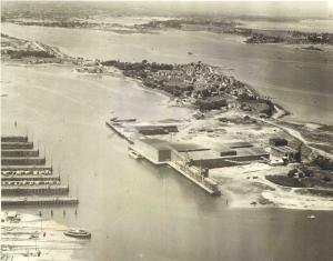
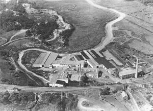
Aerial view of Fort Point | PDF Map View | |
Aerial photo of Bradley Fertilizer Works. At one time "the works" purported to be the largest Fertilizer Works in the World. The Fertilizer was primarily made from phosphates. Image provided by: Jodi Purdy-Quinlan, Vice Chairman of the Weymouth Historical Commission (1938). |
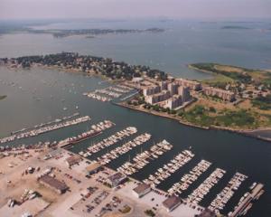
Fort Point Aerial 2002. |
|
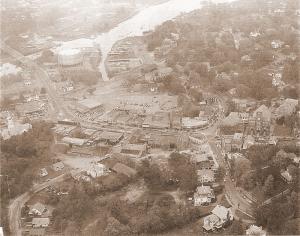
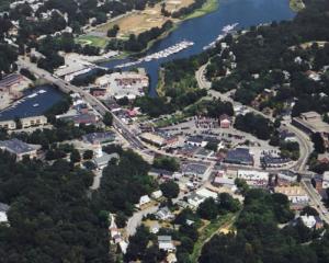
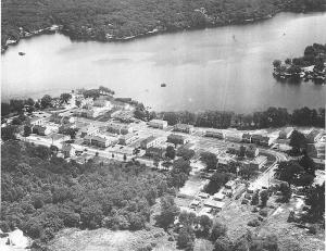
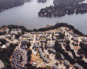
Aerial View of Weymouth Landing | PDF Map View | |
Aerial photo of Weymouth Landing (1951). Image provided by: Jodi Purdy-Quinlan, Vice Chairman of the Weymouth Historical Commission. |
Weymouth Landing Aerial 2002. |
|
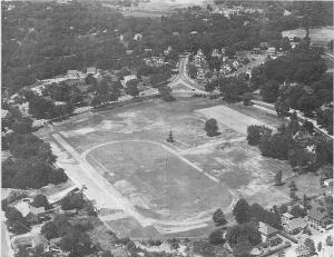
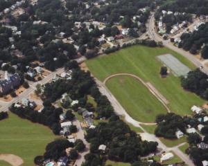
Aerial View of Legion Field | PDF Map View | |
Aerial photo of Legion Field (1951). Image provided by: Jodi Purdy-Quinlan, Vice Chairman of the Weymouth Historical Commission. |
Legion Field Aerial 2002. |
|
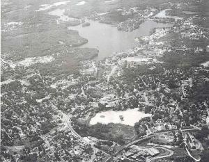
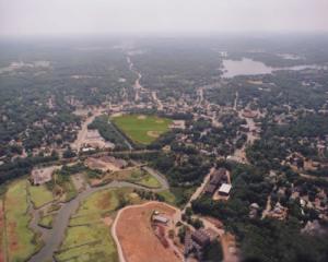
Aerial long view of Whitman’s Pond | PDF Map View | |
Aerial photo of East Weymouth. White area in forground is a sand pit. The sand pit is now occupied by the Lawrence W. Pingree Primary School. Large area of water at the top of the photo is Whitman's Pond. Image provided by: Jodi Purdy-Quinlan, Vice Chairman of the Weymouth Historical Commission (????) |
|
|
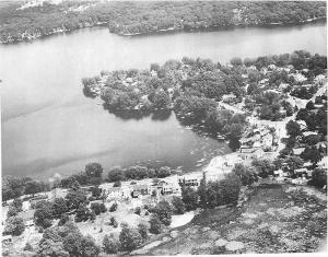
Aerial view of Whitman’s Pond with Lake St. | PDF Map View | |
Aerial photo of Whitman’s Pond (1951) - Lake Street Housing Projects (this housing project was constructed for World War Two Veterans who were returning from the war), Lake Shore Drive , The Birches. Image provided by: Jodi Purdy-Quinlan, Vice Chairman of the Weymouth Historical Commission. |
Aerial photo of site of Whitman's Pond, Lake Street in forground 2002. |
|
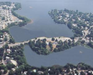
View of Whitman’s Pond with Middle Street | PDF Map View | |
Aerial photo of Whitman’s Pond (1951) - Lake Street Housing Projects (this housing project was constructed for World War Two Veterans who were returning from the war), Lake Shore Drive , The Birches. Image provided by: Jodi Purdy-Quinlan, Vice Chairman of the Weymouth Historical Commission. |
Aerial photo of site of Whitman's Pond, Middle Street in forground 2002. |
|
Old Aerial of Woolen Mill (East Weymouth) | PDF Map View | |
Aerial photo of Woolen Mill (1938). Train tracks in front is the same route that the Greenbush line will use. Great Esker Park in upper left hand corner and back river in the upper right. Image provided by: Jodi Purdy-Quinlan, Vice Chairman of the Weymouth Historical Commission. |
Aerial photo of site of Woolen Mill East Weymouth 2002. |
|
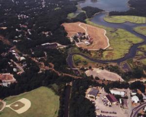
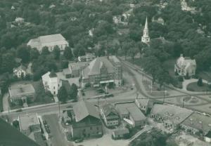
Aerial shot of Columbian Square | PDF Map View | |
Aerial shot of Columbian Square (1938). |
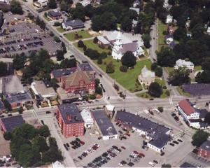
Aerial photo of site of Columbian Square 2002. |
|