
Flood Maps
Flood maps identify areas of land where inundation of water is likely to occur in the event of a 100-year storm. These areas are delineated on nationwide Flood Insurance Rate Maps (FIRMs), which are used in the administration of the National Flood Insurance Program (NFIP) and FEMA's Hazard Mitigation Assistance Programs.
Find the flood map for a specific property address here.
Letter of Map Revision
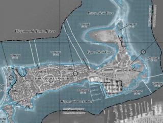
In 2014, the Town sponsored an evaluation of FIRM Panel #2502160227F. This panel delineates Special Flood Hazard Areas along much of the Weymouth Fore River, including Weymouth's Idlewell neighborhood.
Based on the evaluation, the Town filed a Letter of Map Revision (LOMR) proposing the following changes to the FIRM panel:
- A one foot reduction in the Base Flood Elevation (BFE) for the VE (wave action) Zone along the northern shoreline of the Fore River.
- A two foot reduction in the BFE for the VE Zone along the southern shoreline along Idlewell Boulevard.
- A reduction in the width of the VE Zone along both shorelines.
The Town's LOMR was approved in May 2016. This resulted in a number of properties being removed from the 100-year floodplain.
The revised FIRM panel took effect on September 29, 2016.